
An old Medieval Latin proverb famously says that all roads lead to Rome. More accurately, “Mille viae ducunt homines per saecula Romam” – “A thousand roads lead men forever to Rome.” In antiquity, Rome was the center of the Mediterranean world; it stood for centuries as a grand imperial capital and the hub of a wheel whose spokes sprawled outward across its dominions. Roads were the lifeblood that sustained Roman conquest and power, facilitating the transport of goods, armies, and culture as the republic and later empire grew to its greatest extent. This adage, then, while sometimes cliché to modern ears, sheds light on the amazing feat that is the Roman network of roads. “A thousand roads lead men forever to Rome” – the phrase conveys an inevitability, an understanding that Rome’s might is so unparalleled and great that it is destined to endure forever. It is a testament to this vast network that, from just those words, we can begin to understand the scale of connection the Romans achieved and its impact on the ancient world.
Upon arriving in Rome, you cannot help but feel the weight of history all around you. It was here that, in the eighth century BCE, the fabled Romulus founded the city on the very same hill that would serve as the seat of power of an empire hundreds of years in the future. This was the meeting point of all the major aqueducts, where fountains and baths were fed and political moves decided. Not far from my apartment, Julius Caesar was assassinated in 44 BCE in the old Theatre of Pompey, and so it was right down the street that a republic became an empire. In experiencing such a storied place, the idea that has fascinated me the most is that of Rome presiding over such great swaths of territory, continuing to push farther outward, and serving as the ultimate crossroads of a civilization. As such, I intend to understand the road network that helped sustain Roman power, both in terms of the planning and engineering involved in developing the routes as well as how roads were used and maintained by the Roman people.
1.1 Origins of the Roman Network of Roads
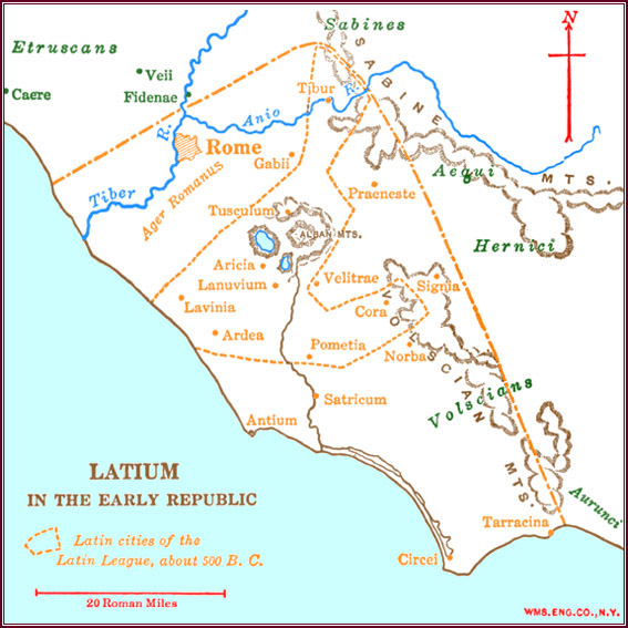
Before the Romans, there existed various tribes across the Italian Peninsula. Two tribes of importance, Etruria and Latium, bordered each other along the Tiber River, with Etruria to the north and Latium to the south. From around 1000 BCE, the land that would be Rome was occupied by several Latin villages and, other than gradual unification of settlements, no real changes occurred until the Etruscans seized the Roman hills and founded the city roughly 400 years later (Frank, 1923). At this point, myth and reality are intertwined, and we can infer from legend that Rome was then ruled by seven kings during its regal period. The last Etruscan king was Tarquin the Proud who, because of his greed and tyranny, was deposed by the Roman people. The state of Latium at this time, immediately after the reign of the Etruscans, is depicted in Figure 1. Under the Etruscan princes, Rome had grown to control all of Latium as well as the only crossings across the Tiber, making it the most developed city in the region (Frank, 1923). This expansion of power continued after the establishment of the Roman Republic, with the Romans eventually defeating and absorbing surrounding tribes including the Etruscans and Sabines.
As was previously mentioned, a primary reason Rome grew to dominate its neighbors was due to its control of early roads through the region. Firstly, due to the city’s advantageous position on hills overlooking the Tiber, it was possible to build and protect a bridge crossing over the river. This, in combination with the Roman occupation of Gabii, a town upstream which held the only other land crossing (shown in Figure 1), allowed Rome to control all north-south land passage through the region. Rome also benefited from control of the road to the salt flats along the western coast as this was where the interior tribes of the region sourced their salts (Frank, 1923). It is clear, then, that roads have served a vital role in building Roman power since the city’s inception.
It was during the Saminite Wars that, in 312 BCE, the Appian Way began construction as the first major Roman road. At this time, Roman control over Latium had been consolidated. South of Rome were the Saminites, an Italic tribe, and the Greek colonies of Magna Graecia (De Benedictis, 2023). In Rome’s quest to expand its footprint on the Italian Peninsula, it became interested in the southern part of Italy and inevitably clashed with the Saminites, another interested party. It was in this context that the Appian Way was built by the censor Appius Claudius Caecus who, in the midst of war to the south, wanted to assert Rome’s dominance over the regions in between Rome and the road’s original terminus of Capua (Berechman, 2003). While earlier roads had been built to connect Rome to the towns it conquered, the Appian Way was unique due to the scale at which it was built, both in terms of size and distance.
Through to the end of the first century BCE, republican Rome practiced the act of conquest at an extraordinary scale. The jewel of these conquests were the three Punic Wars against Carthage, spanning from 264 to 146 BCE, by the end of which Rome controlled Sicily, Spain, and the Western Mediterranean coast. The Third Punic War culminated in the destruction of Carthage itself and left Rome well positioned to continue its expansion into North Africa and the Eastern Mediterranean (Berechman, 2003). Despite these successes, the end of the republican period saw growing unrest and civil war – the political disarray at this time is exemplified by the dictatorship and subsequent assasination of Julius Caesar. When the Senate granted Octavian the title of emperor in 27 BCE, the Roman Republic ceased to exist and the imperial period began. It was during the subsequent long line of emperors that the majority of Roman road construction occurred.
2.1 Routes
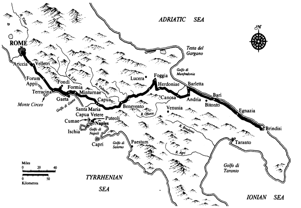
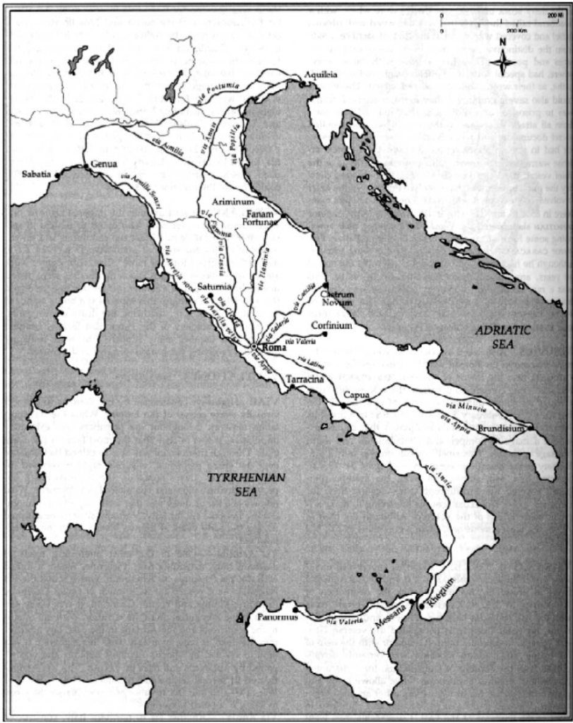
The primary reason for the construction of the Roman road network was to facilitate military movements. As Berechman (2003) writes, “Since war was one of the empire’s major enterprises, huge amounts of economic resources were dedicated to this end. Road building was a major part of these efforts” (454). In studying the routes of Roman roads, it is clear that they were built to support the conquest and control of foreign lands. Indeed, as seen above, the construction of the Appian Way was fueled by the desire to both expand Rome’s presence in Southern Italy and maintain a supply of troops in the war against the Saminites. The road was constructed in segments, first reaching Capua, then Beneventum (modern Benevento), and finally Brundisium (modern Brindisi) as Roman military campaigns against the Saminites moved farther south. This route can be traced using Figure 2 and contextualized as a part of the greater road network with Figure 3. Brundisium, a port city on the southern Adriatic coast, served as a strategic destination for further expansion, allowing troops to sail to friendly ports across the sea. This access proved valuable to the Romans during their conquest of Greece (De Benedictis, 2023).
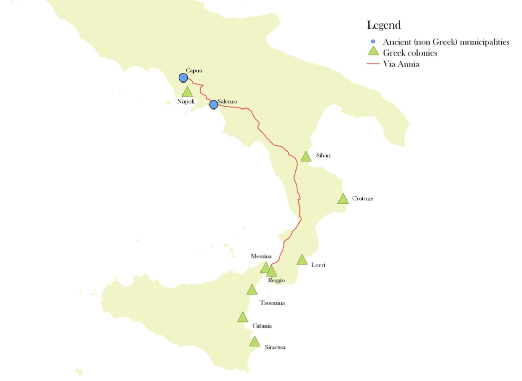
It was in this way that roads were planned and routes decided and, as such, the same military-driven logic can be found in the routes of many other major Roman highways. Via Flaminia (see Figure 3), commissioned by the censor Flaminius in 220 BCE, was built in order to connect Rome to the colony of Arminum (Berechman, 2003). This road served to maintain Roman control over formerly Celtic territory and eventually became the major route to the northern colonies. Similarly, Via Annia to the south was a major highway connecting Capua to Regium (modern Reggio Calabria) at the southern tip of the Italian Peninsula. Built in 132 BCE by the Roman judiciary, this road’s purpose was to “…ensure military power over the Civitas foederata Regium,” or federated city-state of Regium (De Benedictis, 2023; 1168).
The route of Via Annia reveals two interesting insights regarding Roman road planning – as shown in Figure 4, the road follows the western coast of the peninsula even though many of the major trade centers are to the east. In building these roads, then, we can infer that the emphasis on military use was so great that Rome prioritized connections between strategic military points rather than urban hubs (De Benedictis, 2023). Additionally, we can observe of Via Annia and other Roman roads that they were primarily composed of a series of straight lines abruptly changing direction at various points. Roman highways were planned out in this way to minimize the distance between two points, something that was particularly important for the movement of the Roman army across Italy and beyond (Berechman, 2003). Finally, as a note, notice the hub and spoke design of the road network as depicted in Figure 3. Rome serves as the point of convergence, with roads extending in all directions from the city – this illustrates the purpose of the roads as conduits for military control over Roman territories.
2.2 Surveying & Geographic Barriers
As we now know, Roman roads were laid out as a series of straight lines, a method which had the primary benefit of streamlining military movements. However, regarding the actual process of planning and constructing the roads, the benefit was simply that straight lines were easier to design using ancient surveying techniques. Berechman (2003) describes how sighting marks could be quickly aligned to form straight segments, also noting that it was for the ease of sighting during the surveying process that Roman roads often gravitated towards higher ground. Furthermore, while roads would sometimes follow the terrain of a river or ridge, this was still done using smaller linear segments – it was only in extremely mountainous areas that roads possessed the natural curvature commonly seen today.
Primary geographic challenges faced by the Romans in constructing their road network included marshes, lakes, rivers, and mountainous terrain. In order to ensure the stability of a road, especially when traversing marshes, they built causeways supported by wooden foundations. First, two rows of cross beams were laid in the soil with two meters between each beam and a gap separating the rows. The beams were then secured using stakes pounded in at either end and two continuous rows of joists were placed on top. Finally, above the joists were laid a solid series of tree trunks, limestone slabs, and gravel (Mertens, 1955, as cited in Berechman, 2003). This design provided protection for the road against being overcome by marshy or otherwise unstable soil.
As it was the preference of the Romans to build in straight lines, their default approach when met with mountainous terrain was to cut a path through the rock. In the face of a particularly arduous landscape, another option was to simply go around the obstacle, a method that can be observed in the abrupt changes in direction Roman roads sometimes experience. Indeed, the original route of the Appian Way after it reached Tarracina required many switchbacks as the road snaked through the mountains. It was only in the imperial period that a passage was cut straight through the unruly terrain, demonstrating the dynamic nature of road construction as Rome and its technological prowess grew (McShane & Buller, 2022). Finally, the last resort for traversing rough terrain was carving a tunnel through the rock, an example of which is the 38-meter tunnel of Furbo on Via Flaminia (Berechman, 2003).
3.1 Road Use
The most obvious use of Roman roads when considering why and how they were constructed was for the movement of legions throughout Rome. From the various examples provided in previous sections, it is clear that the road network was frequently utilized by the military to transport its troops to their destination over the shortest possible distance. This form of direct travel was important, “…as transportation between towns and army camps was an essential requirement for the conduct of military campaigns” (Berechman, 2003; 474). Even after control over a region was established, efficient connection between regions allowed the Roman military to effectively police conquered areas into continued submission.
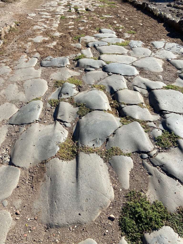
While traveling by foot was by far the most prevalent form of transportation within cities, Romans journeying across longer distances mostly traveled via a vehicle of some sort or on horseback. Two main vehicles used by the Romans were the carrus and raeda. The carrus resembled a standard chariot, could hold one driver and one passenger, and was typically pulled by two to four horses. The raeda, most likely the main vehicle for long-distance travel, was composed of a tall, box-like structure with seating inside. It had four wheels instead of two and was pulled by a team of oxen, horses, or mules – as such, it could carry more people (“Roman roads,” 2026). These vehicles, along with pedestrians, would have been a normal sight along the major Roman highways – in fact, as seen in Figures 4 and 5, evidence of their use still exists in the form of cartwheel ruts worn into the remaining basalt stones.
Over time, various services evolved to take advantage of this flow of travelers – they, too, are an integral part of the road network and how it existed in ancient Rome. The government provided mansiones, or “staying places,” for traveling officials which essentially operated as private villas. Small camps or towns often grew around these larger lodgings. Regular travelers, on the other hand, were relegated to the more disreputable cauponae (inns) or, if they were wealthy, tabernae (a sort of hostel). Gradually, these settlements became interspersed at crossroads and around mansiones, providing boarding and services to weary travelers. One important service that would have been available to travelers was a business servicing vehicles and animals by providing the expertise of cartwrights and veterinarians (“Roman roads,” 2026). Finally, the cursus publicus, established by Emperor Augustus, was a postal service which used a system of relay runners to deliver mail throughout the Roman road network. While initially, this system was only used for official messages, it eventually grew to accommodate private mail as well (Berechman, 2003). Despite the fact that the road network was primarily built to achieve military ends, it is clear that it grew to sustain a diverse set of uses as Rome developed. Indeed, it is the very existence of these uses within the Roman road network which demonstrate its mastery.
3.2 Road Use: The Appian Way Today
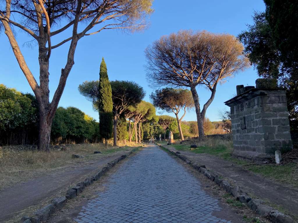
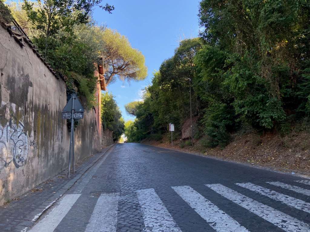
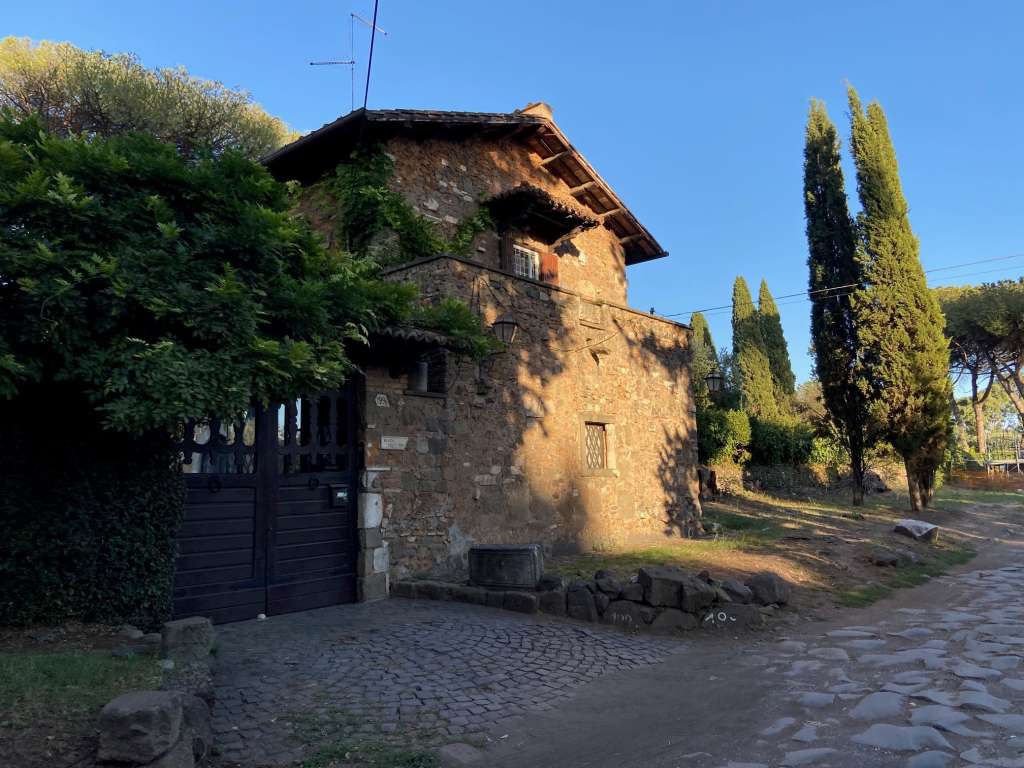
In order to actually see and experience the Roman road network myself, I visited the first and most famous of its roads: the Appian Way. The regina viarum (queen of roads) of antiquity is today called Via Appia Antica and begins southwest of the Baths of Caracalla in Rome. The road’s completely straight route has been preserved over more than two millennia, now existing in sharp contrast to the irregular and winding nature of most streets in the city. It is clear from seeing in person the unbroken sightline created by the road, as shown in Figure 7, that it was designed to transport legions and expand an empire. While this military use faded with the fall of Rome, the legacy of the Appian Way as a major Roman thoroughfare has endured into modern times. Today, much of the initial section of the road operates as a normal street such that visitors expecting a pastoral lane could not be faulted for thinking they were in the wrong place. Observe the scene in Figure 8 – lanes mark the street’s edge, crosswalks and bus stops direct pedestrians, and signs tell drivers to yield or stop. This is indeed a modern road, but the use has remained the same. The car is akin to the carrus, the raeda akin to the bus, and so on. The similarities are again evident in Figure 9; though the building is obviously not of ancient origin, one could easily imagine it to be a mansio or taberna at which travelers stop for the night on their way to Rome.
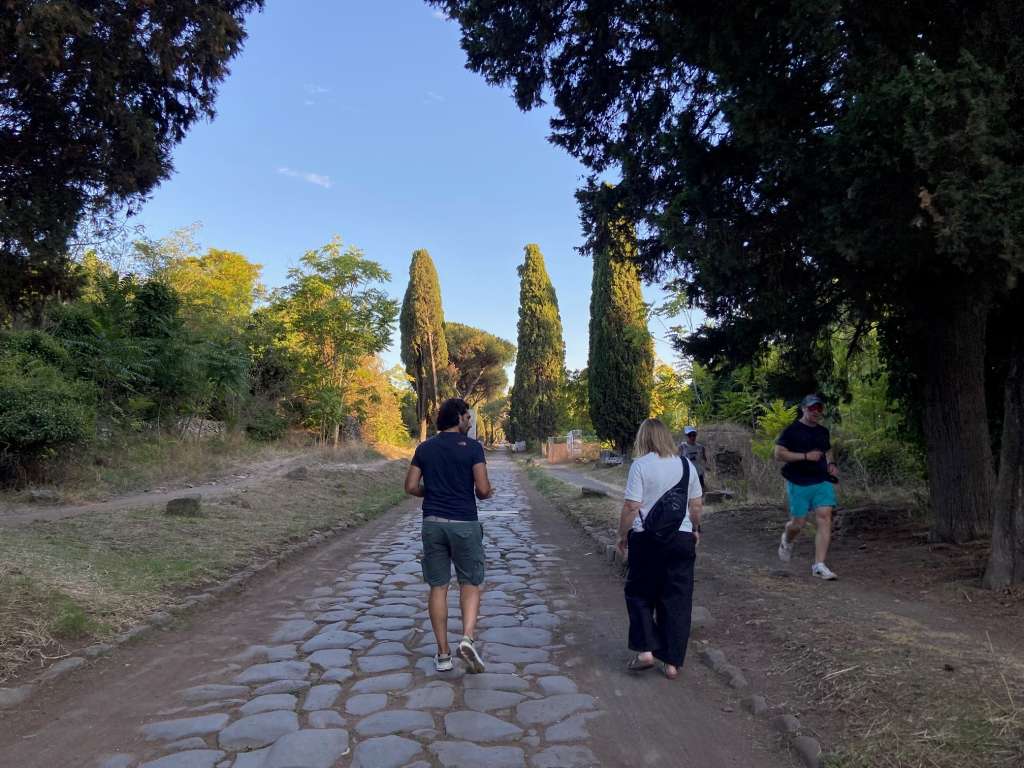
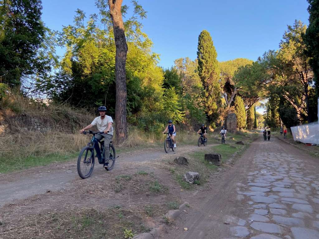
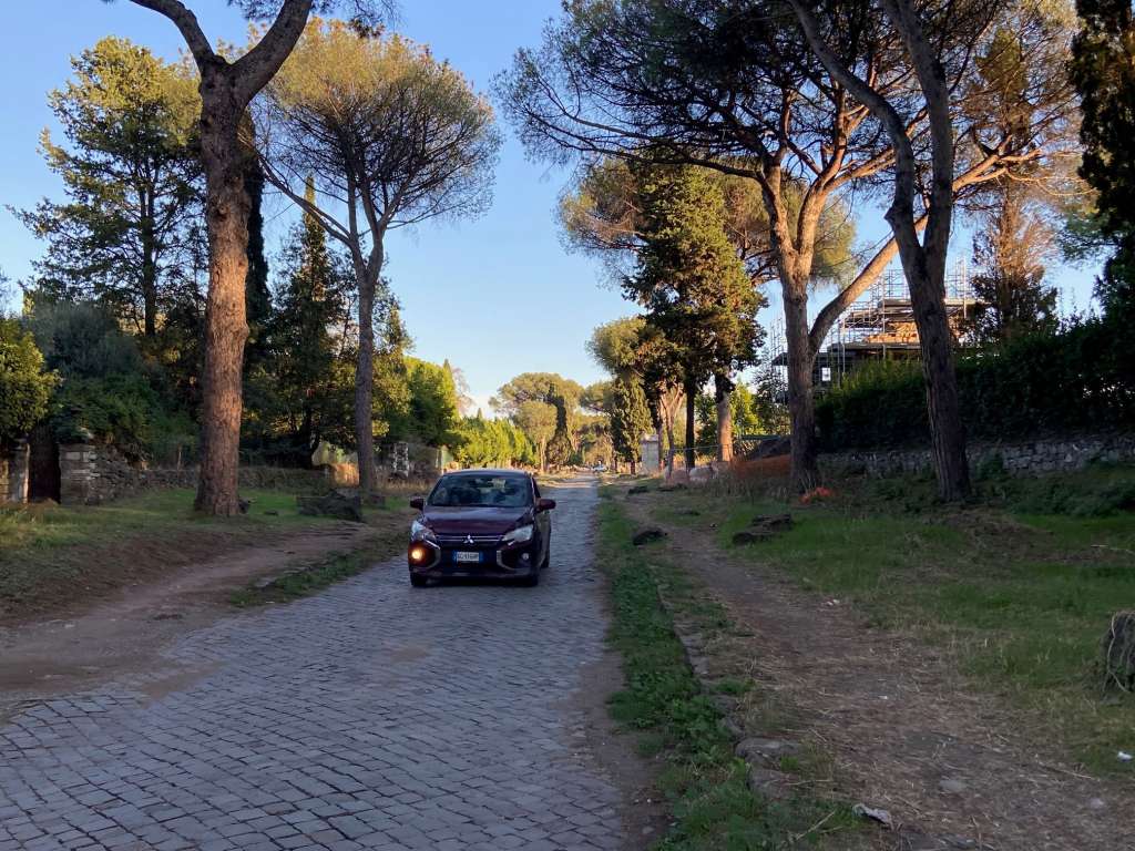
As the Appian Way journeys away from the city, it becomes the road we know in 2026 – a quiet, tree-lined promenade – which generally exhibits a different kind of road use than its predecessor. Now part of the Parco Regionale dell’Appia Antica, this surviving section of the old thoroughfare offers a tranquil atmosphere and is a favorite spot for escaping the city into nature. Figure 10 depicts fellow walkers meandering over the basalt stones and runners jogging by on the dirt paths flanking the road. The Appian Way is also popular as a place to bike, as seen by the bikers racing past in Figure 11. Cars are even allowed on this section of the road, shown in Figure 12, though it seems that they very rarely use it. Overall, the road today is used by people exercising, enjoying the fresh air, and traveling across it much as they would have two millennia ago, if not with less purpose and more leisure.
3.3 Construction & Maintenance
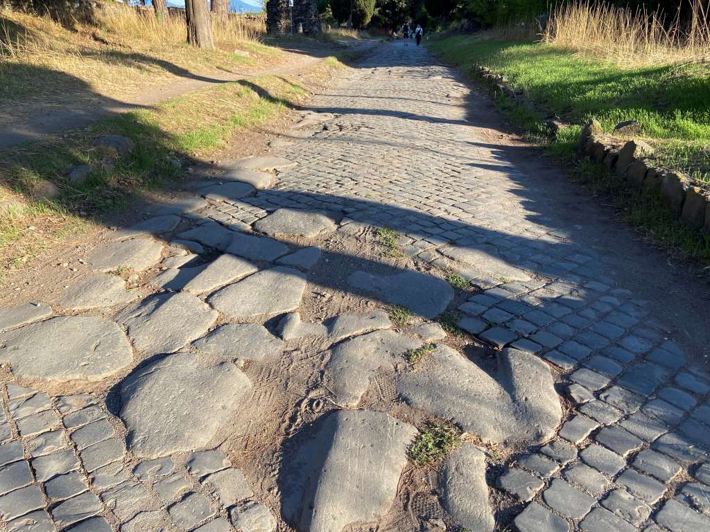
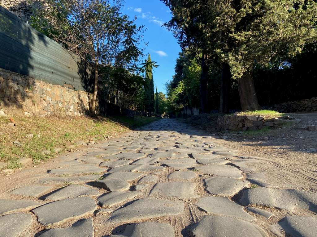
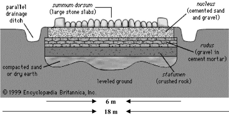
The roads of Rome were built to last and, naturally, this began with their construction. Berechman (2003) details how multiple foundational levels supported a road and ensured its durability under the flow of traffic. First, the path of the road was laid out and the top soil loosened using a wheel plow. Excavation began with digging the gutters situated on either side of the road and then worked through the intermediary soil, in both cases until a solid foundation was reached. After the earth was carried away and the ground leveled, a 3-inch lime mortar sub-base was laid in order to further equalize irregularities in the soil. Next, the two base layers were laid, with two layers of large stone blocks below and a concrete-like layer of coarse aggregates and lime mortar above. The super-base layer consisted of a nearly identical mixture, instead using hot lime and coarse sand in order to better bond to the uneven surface on which it was placed. Finally, basalt stones were laid as the top layer and 18-inch curbstones were placed on each side of the road as its barriers (Berechman, 2003). On the Appian Way, much of the original basalt surface is still in use – one stretch of road with its stones intact is shown in Figure 13. Furthermore, a cross section of a Roman road with all the aforementioned layers is depicted in Figure 14.
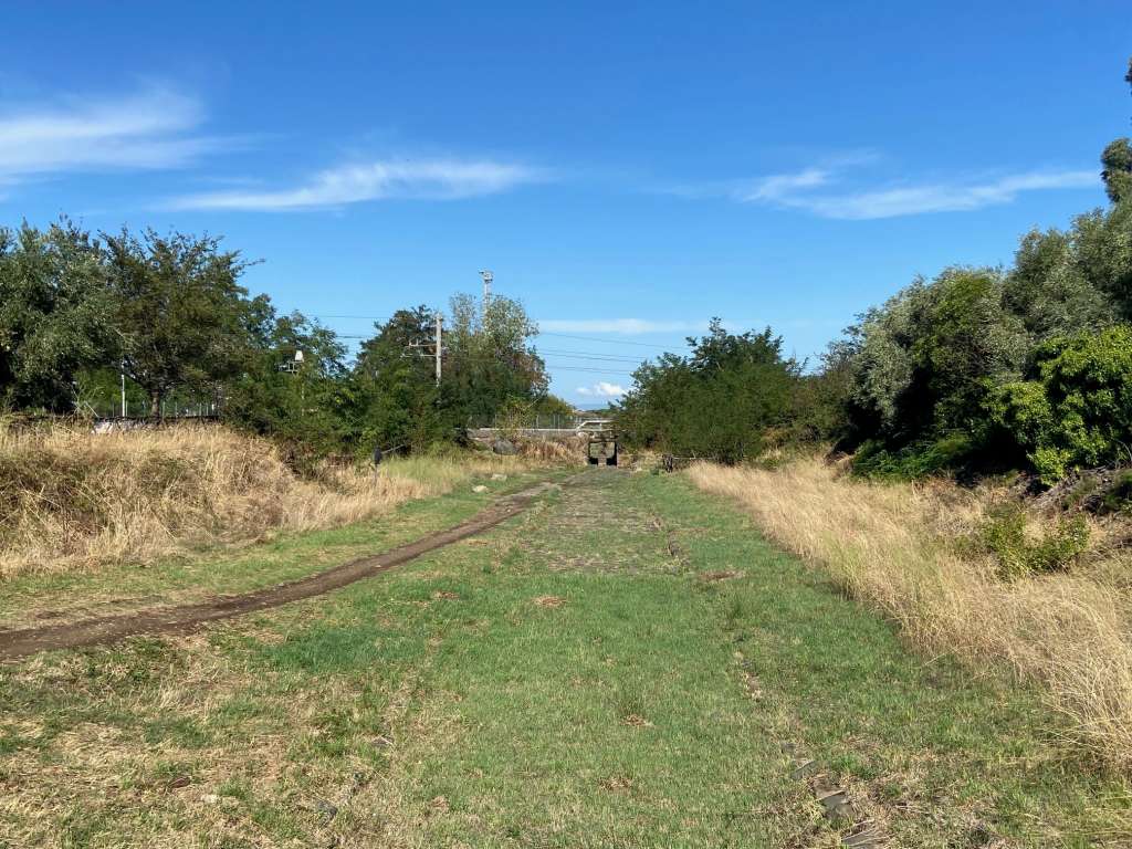
Studying how the Romans built their roads gives insight into the methods they used to ensure their infrastructure was durable enough to withstand significant and continuous pressure. For example, excavating a solid foundation provided a road with a stable surface that could reliably absorb the loads created by the road itself as well as by carts, horses, goods, and people. Additionally, the lime mortar and concrete-like mixtures acted as a sort of bonding agent, securing the large blocks of stone above and below them and creating a level surface on which to lay another layer. This method of construction, along with policies protecting the roads, is what allowed them to be used continuously for centuries. One policy that illustrates Roman efforts to preserve their roads is a law stating that freight wagons (a version of the raeda used to transport cargo) could not haul in excess of 750 pounds (Berechman, 2003). In fact, instances in which roads became heavily damaged often occurred due to the route itself being abandoned; in the case of the Appian Way, the opening of a more direct route between Beneventum and Brundisium in 109 CE caused that segment of the road to fall into disrepair in a mere 20 years (Berechman, 2003). In modern times, even the Appian Way near Rome, as seen in Figure 15, has been subject to the disrepair described above. In this case, grass and mud have all but covered the road’s stones and it can be vividly understood how unused routes were forgotten so quickly.
3.4 Economic Benefits
In an economic sense, the undertaking of a Roman road network can be thought of as a massive public works project. Roads were a very public enterprise, being built using public funds sourced either from the people or government officials. In republican times, when the scale of construction was smaller, the landowners whose estates were bisected by a road would often have to contribute to its costs. In other cases, censors or generals would finance a road out of their own pockets and, by the imperial period, it was generally the emperor who paid for a road’s construction (Berechman, 2003). A public road served as a symbol of imperial generosity and power, demonstrating to the citizenry that the empire served the people and that it was formidable enough to provide them with these extensive public amenities. To this end, road construction also often served to stimulate the local economy through the employment of local workers.
As Berechman (2003) writes, once roads were built and ready for use, they became a part of a network which served as the critical link between Rome’s seaports and its interior. Marine trade routes connected the far territories of the empire, bringing grain from Egypt and precious metals from Spain, and these goods poured into Rome at an astounding rate – 300,000 ounces of gold and 136,077 metric tons of Egyptian grain per year, for example. Roman roads helped sustain this level of trade across the Mediterranean by collecting the goods and distributing them throughout the countryside. Of course, there is also the exporting of goods from and within the Roman interior; agriculture, for example – a major player in the Roman economy – was greatly benefited by the advent of the road network. As cities ballooned in population during the imperial period, roads existed as an important link between rural and urban. Farmers began to sell their surplus produce to the large urban centers which, in turn, became reliant on that supply to keep their people fed. In this way, the network developed yet another purpose in connecting the empire, facilitating agricultural trade routes and, thus, a productive agricultural sector within Rome (Berechman, 2003).
4.1 Reflection
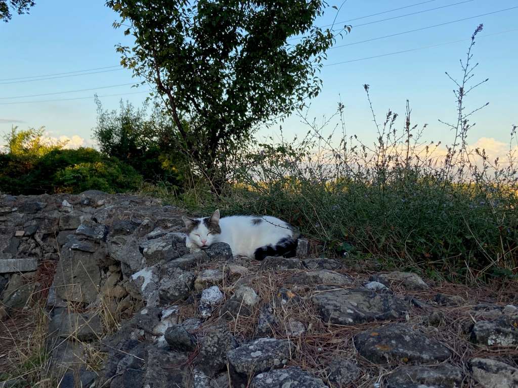
When I was walking along the Appian Way at sunset, listening to the birds chirping and watching the occasional cat (see Figure 16), all I could think about was how it was this very road which began hundreds of years of Roman highway construction. These stones that I walked on were laid over two millennia ago – they are the same ones the blind censor Appius is said to have crossed to feel with his feet that they were well placed (McShane & Buller, 2022). My entire time in Italy has been a series of these moments of disbelief, trying to comprehend the incredible history of a place that I am seeing with my own eyes. For example, it is one thing to know that Romans built the Appian Way in a straight line from Rome to Terracina, but seeing in person how the road looks as if it goes on forever adds an appreciation for the project that cannot be otherwise understood.
Before spending this month in Italy, I knew nothing about Roman roads beyond the saying “All roads lead to Rome.” I vaguely knew of the Appian Way, but only as an old Roman road that was now a popular walking path. As such, researching the historical and engineering context behind Rome’s road network revealed a lot that I did not expect, the most surprising of which was that the roads actually facilitated the expansion of the Roman Empire. The Romans used roads as tools of strategy in conquest and control, placing them in regions in which they wanted to maintain a presence and optimizing their shape for the movement of legions. I had never really thought much about roads in this way before and was amazed by the level of intention of the Romans in planning, surveying, and constructing their network. I know that, today, a lot of thought goes into the placement of highways and other transportation infrastructure, but I suppose I assumed that, in antiquity, this kind of foresight would not have been a priority. Learning how wrong I was makes me think about how these types of decisions really do affect how we move through and experience the world today.
As an example, after having taken various trains in Italy – both high-speed between urban centers and regional to small towns – I am amazed by the level of access offered to people by this network. It is incredibly easy and cheap to gather your things, head to the train station, buy a ticket, and get on a train. All the while, I wonder why we do not have the same thing in the States. Even taking the train or a bus to various natural areas has me making comparisons – “if this were the U.S., the only way to get here would be by car.” Reflecting on the intentionality exhibited by Rome in building a road network, it is frustrating to see how the infrastructure we have built in the United States works to limit access to certain places or specific types of travel instead of improving it. This frustration is compounded by the fact that it has been possible to ensure that kind of accessibility as a part of our networks for decades, as evidenced by the fact that Italy’s extensive train network does just that. Without a car, it is harder to travel cross-country, experience nature, and even move between cities and towns. With one, it is still more of an ordeal than taking the train.
Suffice it to say, I have been impressed by the relative convenience of travel across Italy and Europe in general. I feel that the trains that connect Italy today are the legacy of the roads the Romans once built – in both cases, they have worked to significantly improve the ability of people to travel between places. This desire to provide this type of infrastructure for people is even evident in the case of Metro Linea C – though it is expensive, riddled with obstacles, and will take forever to complete, the fact that it is getting built against all odds conveys a distinct mentality in Rome that the U.S. does not have. Overall, this project on the Roman road network has made me think more about the influence of transportation infrastructure on how we experience the world. I think about the ways that such an extensive road network changed the way Romans lived and hope that, someday, we can also experience such a change.
4.2 Conclusion
The construction of the Appian Way to Capua in 312 BCE secured Roman dominance over the Saminites and set a precedent for the role of roads as conduits of Roman power. Through the republican and imperial periods, Rome utilized its road network to connect and oversee the territories of its vast empire. The military incentives that fueled the growth of this network are evident in how the routes were planned – roads were often built when the Romans wanted to consolidate control in a region and are characterized by straight segments and the prioritization of strategic military locations as destinations along the route. In surveying and planning, geographic barriers were also a major consideration, with insurmountable obstacles resulting in the abrupt changes in direction sometimes seen in the paths of old Roman roads. Additionally, in order to ensure their roads would last, Romans employed a complex method of construction in which five layers of stone and mortar worked to provide the road with a strong foundation and adhere each layer to the next. Today, various examples of these roads are still intact and one can walk along the same basalt stones that were placed millennia ago.
Having been built to maintain and expand imperial control, the road network was naturally used for military movements across the empire. However, over time, it also grew to be the lifeblood of connection and trade. Roads facilitated the movement of goods between the port cities and the Italian interior, ensuring that Rome could continue to import massive quantities of products and resources from its territories. They supported a variety of uses, including people walking and riding on horseback as well as those riding in a carrus or raeda. Small camps and towns even sprung up throughout the network, growing around the mansiones or tabernae which housed travelers. As is evident from visiting the Appian Way, Rome’s first highway which is still in use today, sections of the road are used very much the same way as in antiquity, just with a modern twist. Other sections farther out from Rome serve more as a leisurely nature trail, with walkers, joggers, and bikers frequenting a road which was once used by travelers and legions.
In analyzing the Roman road network, something as ordinary as a road suddenly becomes a foundational factor in Roman domination over the Western world. Roads were built strategically to extend Rome’s power over an impressively vast territory, and it was both the engineering and intention behind them that made this possible. In the modern day, this legacy of the Romans is visible everywhere humans live. Road networks weave and slither across the globe. Highways connect people and fuel economies. Understanding how the Romans built an empire with the help of their road network allows us to look at the infrastructure around us through a different lens and consider that maybe our roads, like those of the Romans, shape our world much more than we give them credit for.
Bibliography
Berechman, J. (2003). Transportation––economic aspects of Roman highway development: the case of Via Appia. Transportation Research Part A, 37, pp. 453-478. https://canvas.uw.edu/courses/1932111/files/149500914/download?download_frd=1
De Benedictis, L., Licio, V., & Pinna, A. M. (2023). From the historical Roman road network to modern infrastructure in Italy. Journal of Regional Science, 63, 1162–1191. https://doi-org.offcampus.lib.washington.edu/10.1111/jors.12659
Frank, T. (1923). A History of Rome. Henry Holt and Company, Chapter II, pp. 14-29. bit.ly/FRAAHR2
McShane, R. B. & Buller, J. L. (2022). Building of the Appian Way. EBSCOhost. https://www.ebsco.com/research-starters/history/building-appian-way
Roman roads (2026, September 16). In Wikipedia. https://en.wikipedia.org/wiki/Roman_roads